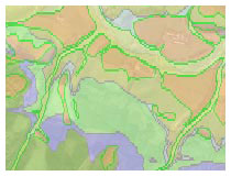
The type of land in the South Downs is important to all other special qualities in the park. The rock types are mostly chalk, with greensands and clays making up the Western Weald.
Over time lots of different landscapes have been created in quite a small area which is a key feature of the National Park. This includes wooded and heathland ridges on the greensands in the Western Weald to wide open downland on top of chalk, which stretches from one end of the National Park to the other. There are river valleys that cross the National Park that create a range of wetland habitats.
There are also hidden villages, farms (large and small), busy market towns and historic estates. They are joined by paths and lanes, many of which are ancient.
You can see the effect of the geology on the landscape as you visit places in the National Park and by finding out more in museums and from local groups.
Resources Toolbox
General Interest
All Ages
-

Be a Water Hero - Southern Water
We live in a water-stressed area and it's important we use this precious resource wisely. -

How to Draw a Field Sketch
A step by step guide to drawing a field sktech by Jackie Day at RSPB Pulborough Brooks. -

South Downs National Park Interactive Map
This interactive pdf allows you to display a variety of map layers: transport, rivers & coast, settlements, landscape types, contours, historical features, population and geology. Download and open in Adobe Reader to turn layers on and off. -

South Downs National Park Interactive Map - legend
This is the legend for the interactive pdf that allows you to display a variety of map layers. -

The Seven Special Landscapes
The underlying geology of the South Downs influences land form, land use and wildlife, creating places of distinctive character and identity. Discover the seven special landscapes and their key features.
Key Stage 1
Ages 5–7
Years 1 and 2
Key Stage 2
Ages 7–11
Years 3, 4, 5 and 6


